图书介绍
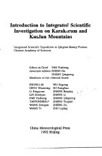
喀喇昆仑山 昆仑山综合科学考察导论 英文2025|PDF|Epub|mobi|kindle电子书版本百度云盘下载

- 潘裕生主编 著
- 出版社: 北京:气象出版社
- ISBN:7502910271
- 出版时间:1992
- 标注页数:92页
- 文件大小:6MB
- 文件页数:100页
- 主题词:
PDF下载
下载说明
喀喇昆仑山 昆仑山综合科学考察导论 英文PDF格式电子书版下载
下载的文件为RAR压缩包。需要使用解压软件进行解压得到PDF格式图书。建议使用BT下载工具Free Download Manager进行下载,简称FDM(免费,没有广告,支持多平台)。本站资源全部打包为BT种子。所以需要使用专业的BT下载软件进行下载。如BitComet qBittorrent uTorrent等BT下载工具。迅雷目前由于本站不是热门资源。不推荐使用!后期资源热门了。安装了迅雷也可以迅雷进行下载!
(文件页数 要大于 标注页数,上中下等多册电子书除外)
注意:本站所有压缩包均有解压码: 点击下载压缩包解压工具
图书目录
Ⅰ. Geology1
1. Introduction1
2. Fundamental Geology1
Preface1
2.1 The North Kunlun Block(NKB)4
2.2 The Oytag-Kudi Suture Zone(OKSZ)6
2.3 The Central Kunlun Block(CKB)8
2.4 The South Kunlun Suture Zone(SKSZ)13
2.5 The Taxkorgan-Tianshuihai Block(TTB)14
2.7 The Karakorum Block(KKB)21
2.6 The Taaxi-Qiaoertianshan-Hongshanhu Suture Zone(TOHSZ)21
3. Regional Geological Evolution22
3.1 Pre-Sinian24
3.2 Sinian24
3.3 Cambrian and Ordovician24
3.4 Ordovician and Silurian25
3.5 Carboniferous-Permian28
3.6 Permian and Triassic28
4. Visiting Localities29
4.1 Hill north of Kashi29
4.2 West Artux30
4.4 One Kilometer north of Oytag31
4.3 Kumtag31
4.5 Near the bridge in Oytag32
4.6 South of cement manufactory in Oytag32
4.7 Valley on the east side of coal mine in Oytag32
4.8 Valley near Dongfeng Coal Mine33
4.9 Ruined cement manufactory in Oytag Valley34
4.10 Ruined coal seam in Oytag Valley34
4.11 Valley of Oytag Village34
4.12 Hill east of Oytag Village34
4.14 Tjunction of Oytag River35
4.13 West of Oytag Village35
4.15 Sub-valley along Oytag Valley36
4.16 Forest of Oytag36
4.17 Western side of entrance to Coal Mine Valley36
4.18 Valley west of Coal Mine Valley36
4.19 Southeast of Arkeqik Village37
4.20 Valley east of hydraulic station37
4.21 Gez check post38
4.26 Northwestern flank of Kongur40
4.25 South of bridge east of Bulungkou40
4.24 East of Bulunkou Pass40
4.22 Tiger mouth west of check post40
4.23 Between Gez and Bulunkou40
4.27 South of traffic station in Bulungkou41
4.28 Baoziya41
4.29 North of traffic station in Kara Kol Lake41
4.30 North of Subax Pass41
4.31 Hot spring in Tahman41
4.32 Active normal boundary fault at the southern and southwestern margins of Tahman Basin43
4.33 Beceel along Taxkorgan River43
4.35 East Valley of Taaxi44
4.34 Valley entrance of West Tizinapu44
4.36 Eastern entrance of Qiate Valley46
4.37 Karajigu46
4.38 Mazar46
References47
Ⅱ. Geography51
1. Introduction51
2. Features and history of landforms51
2.1 Age and amplitude of the uplift53
2.2 Geomorphic regionalization57
2.3 Glacial and Periglacial landforms60
3. Climate62
4. Flora and Fauna66
5. Altitu?inal belts69
6. Land use and nature conservation71
7. Detailed information on the visiting sites73
7.1 Kashgar-Artux73
7.2 Oytag75
7.3 Gez77
7.3.1 Gez River Valley77
7.3.2 Moraines in Kelayayilake Valley79
7.4 Muji Basin80
7.3.3 Debris flow in Erkuran Valley80
7.5 Around the Kara Kol Lake82
7.5.1 Glacial landforms in the west of Mt.Kongur82
7.5.2 Moraines around Kara Kol Lake and Mt.Muztagata83
7.6 Subax Pass84
7.6.1 Subax Pass84
7.6.2 The Paleo-glacial residual of Sikulake glacier near the highway milestone marking 1,710km on the Sino-Pakistan Highway84
7.7 Tahman Basin86
7.8 Taxkorgan River Valley88
References91
热门推荐
- 692607.html
- 901646.html
- 1327096.html
- 2570570.html
- 1233589.html
- 1329852.html
- 2653045.html
- 1225444.html
- 1021111.html
- 2191198.html
- http://www.ickdjs.cc/book_1880131.html
- http://www.ickdjs.cc/book_516208.html
- http://www.ickdjs.cc/book_2971440.html
- http://www.ickdjs.cc/book_2502329.html
- http://www.ickdjs.cc/book_3156509.html
- http://www.ickdjs.cc/book_2708991.html
- http://www.ickdjs.cc/book_2586273.html
- http://www.ickdjs.cc/book_2516780.html
- http://www.ickdjs.cc/book_454364.html
- http://www.ickdjs.cc/book_1281959.html